2016 Atlanta SOTA Seminar

The second annual Atlanta SOTA Seminar will take place on June 9 and 11.

The seminar is designed to help aspiring SOTA activators and chasers get started. On June 9, we will hold an online training session from 7:30 to 9:30 to prepare and plan for our activation. On June 11, we will activate Black Mountain W4G/NG-022. The training is open to hams interested in activating (operating from the summit) and chasing (contacting activators from the comfort of the shack).

Topics

  • How to register for SOTA
  • How to post an activation alert
  • How to plan an activation
  • Collecting your SOTA points
  • The typical SOTA QSO
  • Tracking your SOTA progress
  • What to pack
  • Setting up and tearing down

Requirements

  • The training call is open to all ham radio operators, whether you are interested in activating or chasing.
  • If you want to attend the training call but not the field trip, that is OK.
  • Activators: You must be able to hike about a mile up-hill. (We’ll go slowly!)
    • If you are handicapped, please contact the seminar organizer. We will arrange an accessible activation at another summit.
  • You must be able carry your own supplies for a half-day outdoors. (e.g. sunscreen, water, snack)
  • You do NOT need to have a radio. Bring your own or share a mic/paddle with another seminar participant.
  • You must be a licensed ham radio operator.
  • You must have a computer with an internet connection. (We’re holding our training session via a Google Groups meeting.)

How to Register

(Expired. The event has past.)

See you on the summits! 73 DE K4KPK / Kevin

Where can I find out more?

Bio: K4KPK, Kevin Kleinfelter is Georgia’s first SOTA Mountain Goat. He has completed more than 175 activations.

SOTA Combos

Here are some ideas for combining SOTA summits. Maybe you’d like to activate multiple hills. Maybe you’d like to combine an activation with some other activity. (Yes, there are other activities!)

Triple-headers and More

  • Bell Knob, Cowee Mountain, Huckleberry Knob
  • Big Cedar Mountain (W4G/NG-023), Black Mountain (W4G/NG-022) and Gooch Mountain (W4G/NG-041). Tough, but do-able. I’ve done it.
  • Big Cedar Mountain (W4G/NG-023), Black Mountain (W4G/NG-022) and Rocky Mountain (W4G/NG-050). I haven’t tried this one yet.
  • Blue Mountain (W4G/NG-010), Rocky Mountain (W4G/NG-011) and Tray Mountain (W4G/NG-005). Tough, but do-able. I’ve done it. Three trailheads, not thru-hiking.
  • Dyer Mountain, Flat Top, Copwen, Bald, Grassy. I’ve never been able to fit them all into one day. I’m convinced it could be done. The Flat Top drive really requires 4WD, but I did it once in my Corolla.

Double-headers

  • Bald Mountain (W4G_HC-003), Grassy Mountain (HC-007). This is a logical combo. You drive right past Bald on the way to Grassy.

Section Hiking the Appalachian Trail

I’m trying to section hike the AT in Georgia. I’m not including segments I’ve already hiked.

  • Big Cedar Mountain (W4G/NG-023)
    • Arrange transportation (e.g. Appalachian trail shuttle) and hike from Woody Gap to Neels Gap, activating Blood Mountain (W4G/NG-004) too. 11 miles 1-way.
    • Activate, then hike half-way to Blood Mountain (W4G/NG-004) and back. Another day, activate Blood Mountain and hike half-way to Big Cedar and back.
  • Rocky Mountain (W4G/NG-011) to Tray Mountain (W4G/NG-005) - Hike from Indian Grave Gap to Tray Mountain. 1.7 miles 1-way between trailheads. Add round trip for each summit-hike. Total round trip = 7.2 (plus a lot of vertical).
  • Blue Mountain (W4G/NG-010) to Horsetrough Mountain (W4G/NG-009) 6.5 miles 1-way.
  • Blue Mountain via Hogpen Gap at Richard B. Russell Hwy. 7.4 miles 1-way.
  • Levelland Mountain, from the “north.” 4.2 miles 1-way.

Winter Activations

A colleague recently asked, “As winter sets in, I guess you’ll be putting your activating on hold until spring, huh? No chance! We’ll take a look at the virtues of cold-weather activations.

Disclaimers

  1. I’m discussing southeastern winter weather – not winter at 14,000 feet!
  2. You are responsible for ensuring that you don’t freeze to death - not me.

Bonus

In winter months, some SOTA regions offer a 3-point bonus on 8 and 10 point summits. The rationalle is to provide extra incentive when ice and cold temperature set in. In the southeast:

  • Tennessee (W4T) give a winter bonus from December 1 - March 31.
  • Georgia (W4G) gives a winter bonus from December 1 - March 15.
  • Virginia (W4) offers a winter bonus from December 1 - March 15.
  • North and South Carolina (W4C) offer no winter bonus.
  • Alabama (W4A) offers no winter bonus.

Why the differences? SOTA associations are local within guidelines set by the SOTA Management Team. The volunteer who authored the association reference manual for W4C chose “not applicable” for the weather bonus, so there is none; the author of the W4G manual felt that a winter bonus was desirable. W4A doesn’t have summits above 2500 feet.

Chasers are assumed to have heat in the shack, so there’s no bonus for chasers.

Bushwhacking

Many summits require off-trail travel in order to reach them. Bushwhacking is easier when trees are bare and ground vegetation has died back. There’s less brush to push through, you can see where you’re going, and you can see the sun (which is helpful in maintaining your course). As a result, there are many summits which are easier from mid-November through March.

Weather

You may have to contend with ice and snow. While ice and snow make for a treacherous drive, winter views can be breathtaking. There is a particular peace that sets in when snow is falling and yours are the only footprints. Some activators like “postman’s spikes” to provide better traction on an icy trail. Trekking poles help to some extent. Fortunately, in the south we seldom have enough snow to warrant snowshoes.

Warm clothing is essential, particularly when the wind is blowing (and the wind is almost always blowing “up top.”) Keep in mind that you’ll work up a sweat when hiking, and then you’ll be sitting on a mountaintop. WG0AT has commented on the irony of working up a sweat, walking uphill, only to sit still in a freezing wind once you get there. You’ll need to add layers when you stop climbing. Sometimes I wind up with 3 shirts, 3 jackets, and 2 pair of pants.

Consider carrying a closed-cell pad to sit on – sitting on a cold rock will suck the heat right out of you. Rain gear is particularly important. If you are wet in the winter, you’re in trouble. Rain gear can also be used as a wind break, so long as you don’t let yourself get soaked from perspiration. Good gloves can be a challenge. I often wear Thinsulate-insulated gloves or mittens as I set up. I haven’t figured out how to operate CW or to log contacts legibly with gloves on. In bitter cold, you may find that using a digital recorder attached to your headphone jack allows you to dispense with making a written record and you can operate voice-only with gloves. Some people throw a small blanket over their paddle and paddle-hand.

Do take care when driving up a frozen road that you’ll be able to get out when it thaws. Activators have been known to get stuck when the road melts!

Wrap Up

Don’t forget that daylight ends earlier in the winter. You don’t want to get stuck on Mt. Nowhere after dark.

Check Forest Service Motor Vehicle Use Maps to be sure that the road to the trailhead is open. Many USFS roads are closed in January and February; some are closed even longer.

See you on the summits!

73 DE K4KPK / Kevin

Where can I find out more?

  • Official site: http://sotadata.org.uk/
  • Mailing list: https://groups.yahoo.com/groups/summits
  • K4KPK’s site: http://k4kpk.com/content/sota-menu
  • Email me (K4KPK). My email address is available via http://www.qrz.com/db/K4KPK.

Bio

K4KPK, Kevin Kleinfelter is Georgia’s first SOTA Mountain Goat. He has completed more than 165 activations.

This story is Copyright 2015 Kevin P. Kleinfelter. A non-exclusive right to redistribute in electronic or printed form is granted to amateur radio clubs operating in the metro Atlanta area. All other rights reserved.

Travelling Light

Some activators carry everything but the kitchen sink. Others travel light. In this month’s column, we’ll take a look at virtues and techniques for travelling light.

The Wrong Way

I used to think, “If I might need it, I’d best carry it.” On my first activation, I carried a 65 pound pack. In addition to camping gear, I carried:

  • An Elecraft KX3
  • A way-too-big Pelican case.
  • A slingshot, fishing line, and heavy sinker - in case I wanted suspend my antenna from a tree.
  • A Jackite mast.
  • 31’ of antenna wire
  • 4 x 31’ radials
  • An HT
  • Internal batteries, external batteries, and a battery cable
  • A feed line and a BNC-to-binding post connector
  • Extra food and water
  • A big first aid kit
  • etc.

My pack was so heavy that when I fell over, I was like an overturned turtle. I needed help to stand up!

Light Begets Fast Begets Light

The less weight you carry, the faster you can move. The faster you can move, the less time you spend on the trail. The less time on the trail, the less you need to carry. It’s a virtuous cycle.

It isn’t a disaster if you get to the summit and something doesn’t work. Improvise. One activator arrived at a summit without a short wire, critical to his setup. He used a twist tie from his sandwich.

It isn’t a problem if you’re hungry and thirsty when you return to your car. It means you didn’t carry more weight than you needed. (Don’t overdo this one.)

A couple of index cards and a pocken pen are all you need to log your contacts and they weigh much, much less than a netbook or tablet computer (and a waterproof case to carry it).

Carry less radio; carry less antenna; carry fewer provisions. Ask yourself whether you really, really need an item. You need to carry an adequate radio and an adequate antenna. If dry weather is predicted, a large ziplock bag is all you need to keep your gear dry.

A Minimal Pack

Total weight, excluding pack is less than 4 pounds.

(Tie a rock to the string and throw it over a branch. Tie the other end to your antenna wire and haul it up.)

WS0TA doesn’t even carry a pack. He stuffs everything into the pockets of his clothes and wears a water belt.

Wrap-up

I usually carry a few more items such as a cell phone and an HT, but these are non-essential and I’m a wimp. As I revisit summits with a lighter pack, I’m finding them much easier than I did 3 years ago, and I’m finding that I can often visit multiple summits in one day because I can move faster.

See you on the summits!

73 DE K4KPK / Kevin

Where can I find out more?

Bio

K4KPK, Kevin Kleinfelter is Georgia’s first SOTA Mountain Goat. He has completed more than 150 activations.

This story is Copyright 2016 Kevin P. Kleinfelter. A non-exclusive right to redistribute in electronic or printed form is granted to amateur radio clubs operating in the metro Atlanta area. All other rights reserved.

Antennas for Summits

An adequate antenna is a requirement for a successful activation. In this month’s column we’ll look at some popular options for SOTA antennas.

Requirements

  • Lightweight - You’ll have to carry it to the summit.
  • Rapid deploy - You’ll not have time to wait for concrete to cure!
  • Adequate signal - You need to reach 4+ chasers.

Down in the flatlands, you want a really good antenna and you can afford to put a lot of effort into achieving optimum signal. When you’re on a mountain, there’s a different set of trade-offs. There may be a limited weather window or darkness may be closing in and a rapid deploy can make the difference between a successful activation and a scrub.

VHF

If you set off with a 5 watt HT and a rubber duck, you’ll need chasers nearby. Most of the time, you’ll need something better.

You don’t need a 7-element Yagi-Uda atop a 30’ mast for a SOTA activation, although that is certainly an option if you have one and can carry it. A quarter-wave whip will make some contacts. It can be improved with the addition of a “tiger tail.” A tiger tail is just a 1/4 length of light, insulated wire with a ring terminal on the end. You put it over the antenna connector on your HT, screw on the antenna, and you convert your 1/4 wave antenna into a vertical dipole. I work contacts at 100+ miles with 5 watts using one of these. A roll-up slim jim is another popular option.

Line of sight is much, much better from the top of a summit than around town. A rubber duck will work just fine to reach metro Atlanta from Stone Mountain or Kennesaw Mountain. With a quarter wave vertical dipole, you can reach Atlanta from many summits in north Georgia. (Be sure to line up some local chasers in advance, and don’t forget that only simplex contacts count.)

HF

Due to the light weight, most SOTA activators use wire antennas. You can hang your wire vertically from a tree, string your wire horizontally through branches you can reach, or use a lightweight mast. Many activators tie a string to a found rock, throw it over a branch, and hoist up a wire. I’ve got a terrible throwing arm and I like a consistent deploy process, so I carry a carbon fiber mast.

The classic dipole gets good results, and some activators swear by it. This antenna is particularly popular with activators who do not carry an antenna tuner, due to the ability to rig it for low SWR. The most common configuration is an inverted V. If you suspend the center from a mast, you’ll need to carry a mast stiff enough to support it, and that’s generally somewhat heavy. If there are trees on the summit, you can suspend the center and the ends from the trees, but setting up three support points takes longer than I generally like. If the center is up high, you’ll also need to carry a long feed line, which increases your pack weight.

An end-fed is generally the most popular antenna for most activators due to the ease with which it can be deployed. If your radio has an ATU, you can throw one end of a 35.5’ wire over a tree, attach the other end directly to your radio, string a similar length counterpoise through the bushes, and you’re on the air in minutes.

My personal favorite is to zip tie 32’ of wire to a 35’ carbon fiber fishing pole, and to lean the pole against a suitable tree branch. If it’s windy, you’ll need to guy it or to tie it off to the tree. On a treeless summit, three aluminum stakes and three lengths of string will guy it with a few minutes of effort. If you run it through a ‘matchbox’, it’s an end-fed half-wave for 20 meters. (I routinely work the UK and Spain with this.) To switch to 40 meters, run 32’ of wire through the bushes and attach it to the ground terminal on your radio and you have a dipole (or you can think of it as a single-radial vertical, if you prefer).

Wrap-up

  • Start with what you have. If you can get it to the summit, it is good enough to get started. You’ve got elevation working in your favor, and many summits are free of RFI. RF in the shack is not something you have to worry about. (There’s no shack and you’re running low power.) Keep in mind that you only need it to stay up for about an hour; this is not a 20-year antenna!

See you on the summits!

73 DE K4KPK / Kevin

Where can I find out more?

  • A popular EFHW: http://www.lnrprecision.com/endfedz/trail-friendly/
  • EFHW Central: http://www.aa5tb.com/efha.html
  • K4KPK’s site: http://k4kpk.com/content/sota-menu
  • Email me (K4KPK). My email address is available via http://www.qrz.com/db/K4KPK.

Bio

K4KPK, Kevin Kleinfelter is Georgia’s first SOTA Mountain Goat. He has completed more than 150 activations.

This story is Copyright 2015 Kevin P. Kleinfelter. A non-exclusive right to redistribute in electronic or printed form is granted to amateur radio clubs operating in the metro Atlanta area. All other rights reserved.

Portable Power

A power source is a requirement for any successful activation. In this month’s column we’ll look at some popular options for powering SOTA activations. Although the occasional activator will use a kilowatt amp, this article will focus on power for QRP portable rigs.

Step Away From the Car Sir

SOTA rules state:

  • Operations must not be in, or in the close vicinity of, a motor vehicle.
  • All equipment must be operated from a portable power source (batteries, solar cells, etc).

Consequently, most activators carry some kind of battery.

For some activators, a walk across a parking lot is an expedition. Others sniff with disdain at anything less than 5 miles with 2000’ of elevation gain. If you’re lugging your gear across a parking lot, you could haul your car battery across the lot in your grandchild’s wagon; if you’re trekking up Denali, grams count!

The Heavy End

Many hams have a SLAB (Sealed Lead Acid Battery) for field day. This is the technology used in your car battery. You can use your car battery, but it is big and heavy and you need to be sure not to discharge it so far that you can’t start your car.

Gel cells are a common alternative to SLAB. For activator use, they are similar to SLAB, except they need not be kept “sunny side up.” They may require special chargers. The removal of the right-side-up requirement is helpful, but they are heavy enough that you won’t often carry one on the trail.

  • Down-side: High weight-to-power ratio.
  • Up-side: Simple technology; inexpensive.

Low-tech, Middle-weight

Disposable alkaline batteries are a popular choice. If you put enough of them in series and/or parallel, and you can meet meet most any power requirement. Some portable rigs include a battery holder for AA cells.

  • Down-side: Expensive over time; disposal of used cells.
  • Up-side: You can buy them anywhere; low-tech; reliable.

Disposable lithium cells are a similar alternative. They’re a little lighter, more expensive, and have slightly different discharge characteristics. Since they retain their charge for up to a decade, they make a good backup power source. I often carry a set of 8 AA lithium cells as a “plan-B” power source.

For my first two years as an activator, I used rechargeable NiMh (Nickel-metal Hydride) cells. These have a similar form factor to disposable alkaline cells. They are rechargeable 100s of times and do not exhibit the ‘memory effect’ of NiCad. They must be charged in a NiMh-compatible charger. Some varieties won’t hold a charge for more than a week or two, but there are long-life varieties that will hold a charge for a year or so.

  • Down-side: Slightly lower voltage than alkalines.
  • Up-side: Simple charging protocol; inexpensive.

I use a KX3. It is designed to operate at 5 watts with 8 internal NiMh cells, but it will operate at 12 watts if I feed it 14-15 volts. This requires 11 NiMh cells, so I made an custom external battery holder.

High-tech, Lightweight

The cool kids are all using rechargeable lithium batteries. These pack a tremendous amount of power into a small, lightweight package. These are very popular with gram counters. Some of these are physically about the size of an AA cell, but since they are 3 volts, please don’t put them into a device designed for AA batteries!

There are several variants of lithium batteries, with unique characteristics. Collectively, they are known as “lithium ion.” The most popular varieties are Li-Po (lithium polymer) and LiFePO4 (lithium iron phosphate). (LiFePO4 are also referred to as ‘LiFePo’ or ‘LFP.’) They require special chargers – each variety requires a different charging protocol. Don’t mix and match!

Up-side (all varieties):

  • Low weight-to-power ratio.
  • Low volume-to-power ratio.
  • Ability to deliver high current.

Down-side (Li-Po):

  • Power-to-cost ratio is expensive.
  • Easy to ruin with over-charge or over-discharge.
  • Short-circuit may lead to fire.
  • Crush/penetration hazard.
  • Concern over excessive fire risk.

Down-side (LiFePO4):

  • Power-to-cost ratio is expensive.
  • Easy to ruin with over-charge or over-discharge.
  • Short-circuit can lead to fire.

Li-Po and LiFePO4 are popular with RC helicopter pilots, due to their light weight and ability to deliver an ‘insanely high’ current. If you short them, expect a fire. With a low internal resistance, they’ll dump all that power into the short in very short order.

The chemistry of LiFePO4 make them substantially less likely to combust than Li-Po. If you short them, the high heat from all that power is still a risk, but these are much safer than Li-Po.

Note that the cells in a lithim ion battery pack should be managed individually. Each cell will have slightly different capacity. Over-discharging any cell may ruin the battery. Over-changing any cell may ruin the battery or create a fire hazard. You will need a battery pack and a charger that support ‘balanced’ charging. This will allow the charger to charge each cell individually, rather than charging the battery as a whole.

Low-tech, Extremely Lightweight

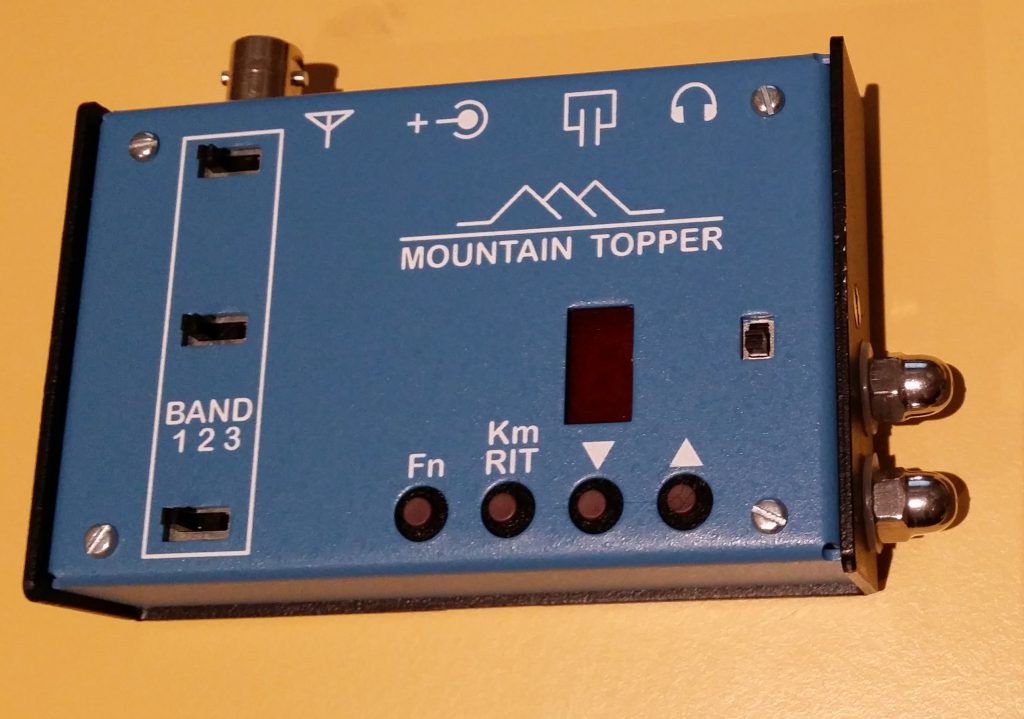
If you want to go really lightweight, consider operating at lower power. Less power intrinsically means less weight. Consider the Mountain Topper (a.k.a MTR, a.k.a. AT-Sprint) radios designed by Steve Weber (KD1JV). These are sometimes sold assembled by LNR, occasionally offered in kit form via a Yahoo mailing list, and turn up on eBay from time to time.

These will operate for many, many QSOs on a standard 9-volt battery. A single alkaline 9-volt battery is reportedly good for more than an hour of activating.

Down-side:

  • Must learn CW.
  • About 3 watts maximum output.

Up-side:

  • Lightest option.
  • Simple, low-tech reliability.

Wrap-up

  • Start with what you have. If you can get it to the summit, it is good enough to get started.
  • If you’ve got nothing suitable, AA NiMh cells are a good start. It is robust technology. You can combine cells with a power wand or mix real cells with dummy cells in a commercial battery holder to provide the desired power.
  • To get maximum power for minimum weight, use LiFePO4.
  • If you want absolute minimum weight, get one of KD1JV’s radios and use a 9-volt disposable lithium battery.

See you on the summits!

73 DE K4KPK / Kevin

Where can I find out more?

  • Wikipedia on balanced charging: https://en.wikipedia.org/wiki/Battery_balancing
  • WB4SON blog on LiFePO4: http://wb4son.com/wpblog/?p=481
  • Official site: http://sotadata.org.uk/
  • Mailing list: https://groups.yahoo.com/groups/summits
  • K4KPK’s site: http://k4kpk.com/content/sota-menu
  • Email me (K4KPK). My email address is available via http://www.qrz.com/db/K4KPK.

Bio

K4KPK, Kevin Kleinfelter is Georgia’s first SOTA Mountain Goat. He has completed more than 150 activations.

This story is Copyright 2015 Kevin P. Kleinfelter. A non-exclusive right to redistribute in electronic or printed form is granted to amateur radio clubs operating in the metro Atlanta area. All other rights reserved.

Finding Your Way to Nowhere

[This month’s topic is about a subject that could get you hurt. Make sure you understand the risks. Do not rely on this content to keep you safe.]

Initial Planning

After you’ve visited a few summits, you may get a hankering to visit a summit that is… out of the way. Perhaps it is on a remote trail. It might require bushwhacking. This month’s topic is how to get to the middle of nowhere.

After you’ve visited http://www.sotamaps.org/, you’ll have a good idea of where your summit is located. You just need to figure out how to get there. (If you’re lucky, there will be a trail marked on SOTAmaps.)

When planning a hike to a summit, the first thing I do is to Google the name of the summit and the words trail, trailhead, or hike. If someone has written up a guide, this search will usually find it.

Topographic Maps

The next resource to check is a USGS topo. Visit http://store.usgs.gov and select “Map Locator & Downloader.” You can use this to download topographic maps (often called “quads” or “quadrangles”). These maps show mountains, streams, dirt roads, trails, and other geographic features. You may have learned to read these as a Scout. You can download PDF files with the exact map you would see on a paper map. These are big files; they will take time to download and your PC display them sloooowly. If you prefer, you can purchase paper maps from the same site.

There will be many editions of a map on the USGS site. I usually download the 2 or 3 most recent, look to see which is intelligible, and discard the rest. The newest edition often adds aerial imagery, which makes them tough to read.

Take a quad with a grain of salt. Just because it shows a road/trail is there, it doesn’t mean the route is passable. If you see a candidate route, use Google Earth to see if you can find evidence that the road/trail is still there. When you travel, the reality on the ground supersedes the reality on the map!

National Geographic Trails Illustrated maps are an excellent resource, if there is a map for your destination. These are much like a quadrangle, except they often contain more relevant detail.

Reaching the Trailhead

Once you’ve found a trail, you’ll need to navigate the drive to your trailhead. Google Maps has worked well for me for 90% of my back-country trailheads. Occasionally, it thinks that a power line right-of-way is a road, so watch out for unnaturally straight lines on the route. Occasionally, it will route you via a closed Forest Service road. You can check for gates on the relevant [Forest Service Motor Vehicle Use Map] (http://www.fs.fed.us/recreation/programs/ohv/ohv_maps.shtml).

A Word About GPS

When you head out into wilderness, you may elect to carry a GPS. Don’t take a GPS designed for use in a car! You don’t want a street GPS; you want a topographic GPS. I recommend using a dedicated GPS and not a smart phone app. The dedicated GPS will show your position more accurately and its batteries will last much longer. (I’ve found multiple people on the trail who were using an app who were not clear on their location.) I recommend a rainproof GPS. I have one with a tiny little screen, and I’ve never really needed a bigger display. You will want a GPS with a moving map display, and not just a latitude/longitude display.

Do not rely on your GPS to get you back to the car. Pay attention to your route. Have a plan for how to find your car if the GPS fails. Risks include electronic device failure, a geomagnetic storm, dead batteries. (I once dropped my GPS as I was crawling through rhododendron.)

Bushwhacking

If you bushwhack, navigating to a summit is easier than navigating back to the trail. If you’re on the right mountain, heading up will eventually reach the summit. When you come down, there are an infinite number of destinations you reach by heading down.

I avoid bushwhacking unless the sun is shining; I prefer to bushwhack in the winter. It is easy to travel in a straight line when you can see your shadow. If your GPS conks out, you should know the general direction to head in order to find the trail. When planning your trip, plan a fail-safe route back to the trail that has you hitting a long stretch of the trail perpendicularly. You want to know that even if you’re off course by 30 degrees, you’ve got a big target to hit.

Wrap-up

I won’t get into general wilderness safety. For that, https://en.wikipedia.org/wiki/Ten_Essentials is a good place to start.

Some really nice summits are off the beaten track. They just require a little more planning. To get you started, guides for several southeastern summits can be found at SOTA Trip Library.

See you on the summits!

73 DE K4KPK / Kevin

Where can I find out more?

  • Official site: http://sotadata.org.uk/
  • Mailing list: https://groups.yahoo.com/groups/summits
  • K4KPK’s site: http://k4kpk.com/content/sota-menu
  • Email me (K4KPK). My email address is available via http://www.qrz.com/db/K4KPK.

Bio

K4KPK, Kevin Kleinfelter is Georgia’s first SOTA Mountain Goat. His first QSO was on a SOTA activation. He has completed more than 150 activations.

This story is Copyright 2015 Kevin P. Kleinfelter. A non-exclusive right to redistribute in electronic or printed form is granted to amateur radio clubs operating in the metro Atlanta area. All other rights reserved.

Where Can I Buy a KD1JV Mountain Topper?

  1. Check eBay. One turns up every few months. Sometimes assembled; sometimes an unassembled kit.
  2. Monitor the AT_Sprint Yahoo mailing list. One turns up every few months. Sometimes assembled; sometimes an unassembled kit.
  3. http://www.lnrprecision.com/ sells assembled MTR for about $250.

SOTA Web Resources

You can’t “do SOTA” without using the web. There is one essential site, several which are almost indispensable, and some that are somewhat useful. You may find it helpful to open a web browser and visit the referenced sites as you read this article.

SOTAData - Essential

sotadata.org.uk - You can’t get by without SOTAData. This is where you record your QSOs. Some of the key activities on the main menu include:

  • Logon/Logoff - You’ll need to visit the “Register” sub-menu to sign up for an account. There’s no cost to register and they don’t spam you. Registering is not a commitment to activate or chase!
  • View Results - You can view metrics about SOTA such as the count of registered summits (73,548), rankings of activators and chasers, and there’s a special sub-menu for viewing your own results including your activations, unique summits, summit-to-summit (S2S) contacts, awards, etc. After each activation I check the “Activator Roll of Honor”… and confirm that I still haven’t earned enough points to move up in the national ranking. :-(
  • Summits - If you’re an activator, you’ll research a summit here before you head out on an expedition. This is where you find the list of official summits, how many points each summit is worth, who has activated it. (Tip: If lots of people have activated it, it is an easy summit.) Once you locate a summit, the “Extra Info” link will take you to a page where prior activators write-up how to get to the summit and what to expect when you arrive. One of the first places to visit when planning an expedition.
  • Submit Log - This is where you record your QSOs. There’s a sub-menu for entering QSOs one at a time. You’ll probably use this for your first few activations/chases. You’ll want to quickly move up to uploading CSV files. The CSV format is unique to SOTA, but several logging apps now support SOTA format.

SOTAWatch - Very Helpful

sotawatch.org is where activators post alerts to tell you when/where they plan to activate. Once a chaser hears an activator, he will typically spot the activation here too. Self-spotting is considered acceptable for SOTA.

If you have an iPhone, SOTA Goat uses SOTAWatch data to bleat a notice whenever a new spot is posted. There are also apps for Android, Windows, and OS X that perform similarly. The data from SOTAWatch is also posted to Twitter.

SOTA Goat and its ilk are particularly helpful if you’re interested in S2S contacts. If you’re on a hill with cell coverage, you can get notified when other activators are on the air, giving you the info you need to call them.

SOTAWatch Chaser/Logger - Interesting for Chasers spotfilter shows recent spots. What makes it interesting is that if you are a busy chaser, you can select spots and then download them into your log book.

SOTAMaps - Very Helpful

sotamaps.org shows the location of summits on a map. This helps you visualize just how far you’re going to have to drive. Here’s a helpful URL which plots 700+ summits within driving distance from Atlanta. The left panel is color coded to show you which summits have/haven’t been activated.

North American SOTA Mailing List - Helpful

groups.yahoo.com/groups/summits hosts the official mailing list for the North American SOTA community. (Yahoo login required.) This is where you can ask other activators and chasers for how-to information. There are some clever antena and balun designs posted here on occasion.

Like many Yahoo groups, a popular pastime is complaining about Yahoo. If you visit the site once, you can sign-up to have postings delivered to your email and you’ll never have to look at Yahoo again.

My SOTA Site - Somewhat Helpful

k4kpk.com/content/sota-menu may also be of interest. It has how-to information, an archive of newsletter articles, and a library of trip plans for southeastern summits.

AR

See you on the summits! 73 DE K4KPK / Kevin

Bio

K4KPK, Kevin Kleinfelter is Georgia’s first SOTA Mountain Goat. He has completed more than 150 activations.

This story is Copyright 2015 Kevin P. Kleinfelter. A non-exclusive right to redistribute in electronic or printed form is granted to amateur radio clubs operating in the metro Atlanta area. All other rights reserved.